Itineraries
Historic Sites
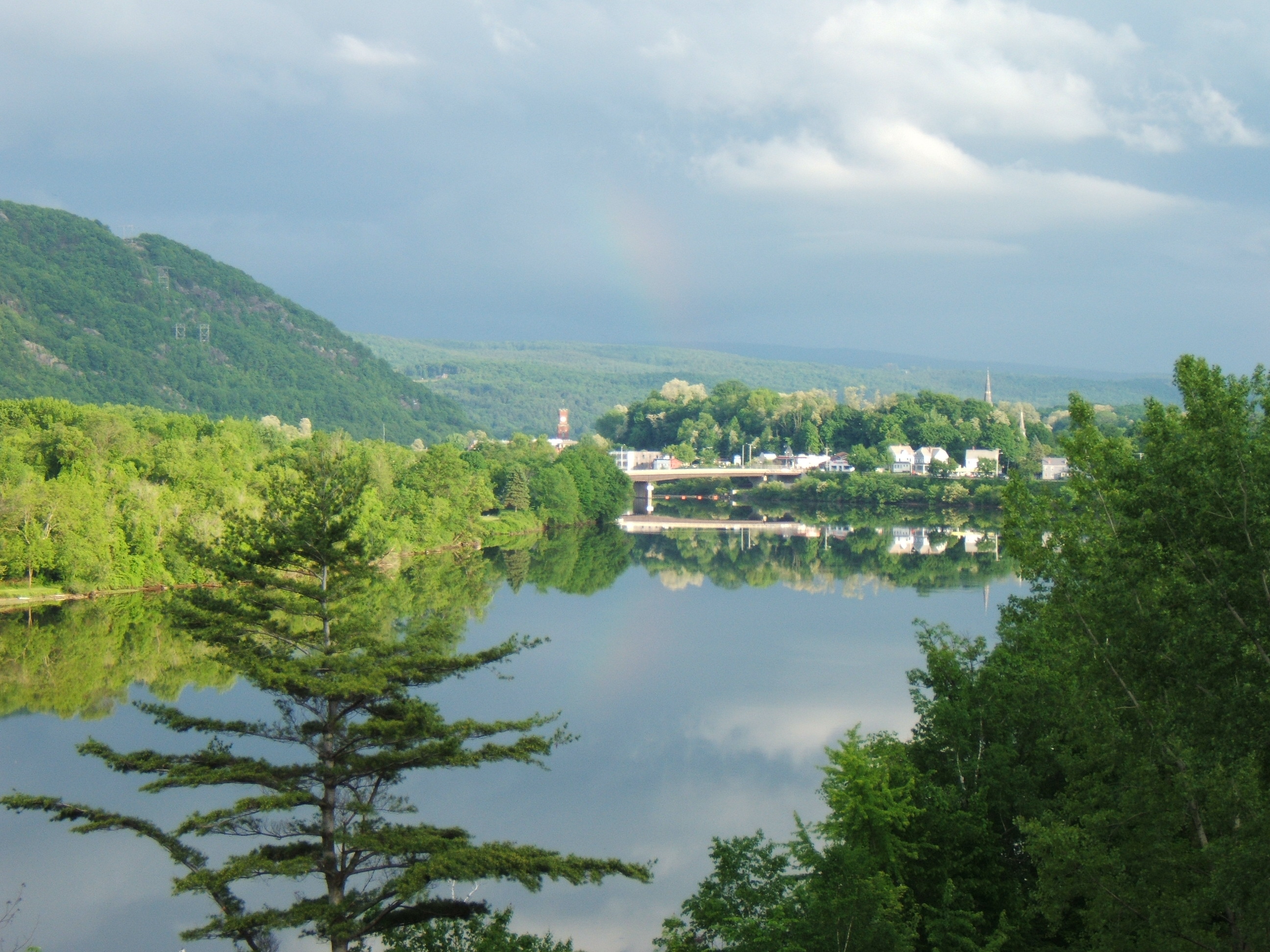
The Connecticut River narrows dramatically into a rocky gorge between Bellows Falls and Walpole. Native Americans gathered seasonally at the Great Falls to harvest migrating salmon and shad. Early bridge-builders took advantage of the short span, so the community became a crossroads for early turnpikes and a hub for railroads. A transportation canal around the falls later powered the growth of major paper factories. Today, Bellows Falls is a village alive with history and culture. Its commercial downtown – and the other small towns in the region – retain the historic feel of the places they became when natural resources were harnessed.
The village of Bellows Falls is set in the town of Rockingham, VT, and is the Waypoint community for an area that includes the towns of Rockingham, Westminster, Putney, and Springfield, VT, and Charlestown and Walpole, NH. Bellows Falls recently celebrated the grand opening of its new Waypoint Visitor Center, adjacent to the Bellows Falls Canal near the train station. The designated Byway routes in the Bellows Falls area are Route 5 in Vermont and Routes 12 and 12A in New Hampshire.
Nature & Scenery
At Bellows Falls, much of the river’s flow is now drawn off into a canal for power generation. But in early Spring, snowmelt swells the river to a thundering cataract in the gorge that recalls the free-falling river prior to the construction of a dam here in the late 1700s. On the New Hampshire shore, Fall Mountain rears its rocky ledges high above the gorge. On the Vermont side, the village of Bellows Falls is set out on glacial terraces.
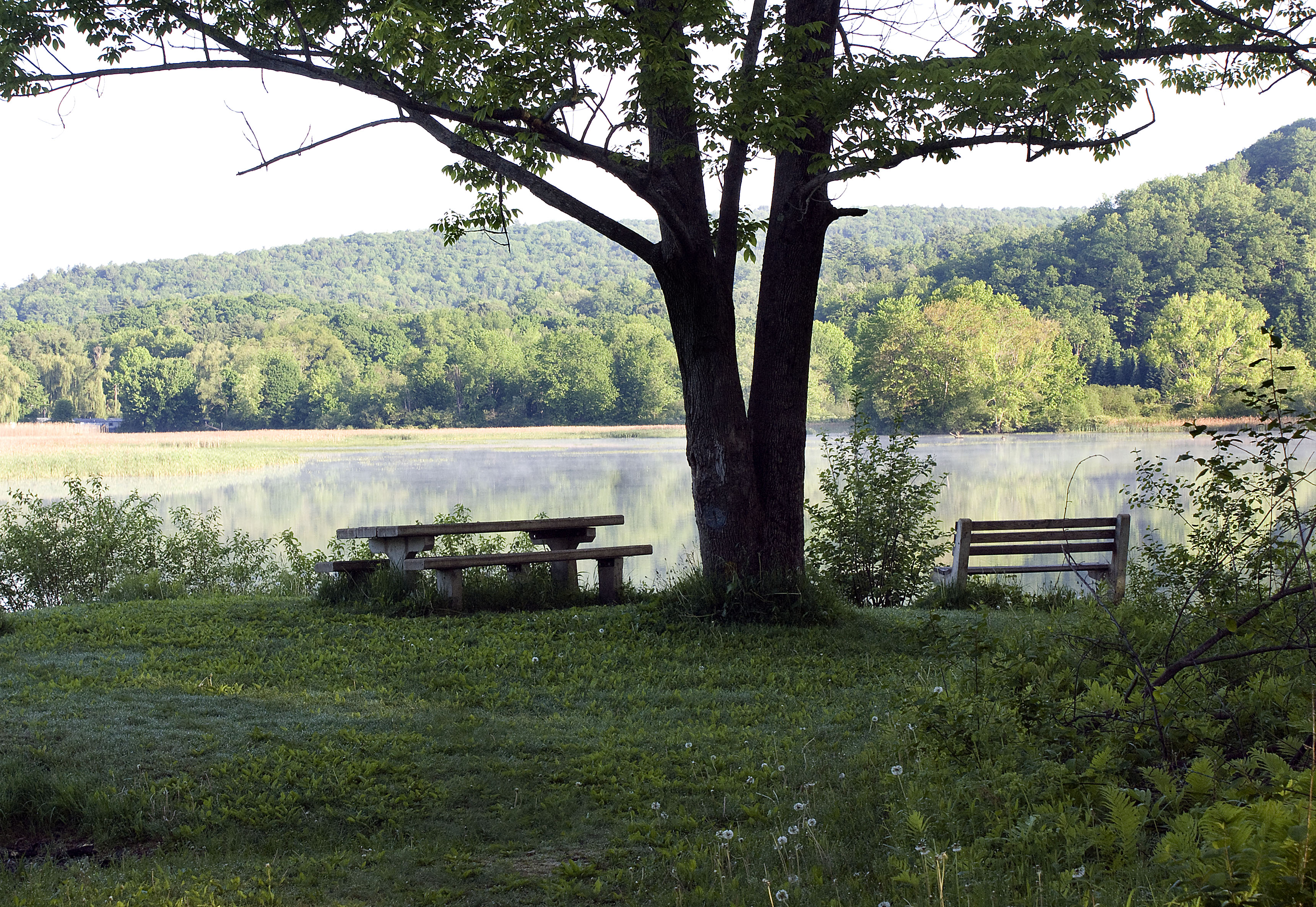 Four tributaries join the Connecticut River in the Bellows Falls area: the Cold River, Saxtons River, Williams River, and the Black River. A dam at Bellows Falls backs up the Connecticut, creating Herrick’s Cove at the mouth of the Williams River, several miles north of Bellows Falls. Herrick’s Cove is a major stopover for migrating waterfowl, which also congregate at the mouth of the Black River at Springfield. The generating station at Bellows Falls includes a small exhibit and viewing window on a fish ladder. Lucky viewers may even see a returning Atlantic salmon or American shad.
Farming
Glacial terraces and flood plains provide well-drained soils for diversified agriculture, including dairy farming, vegetable farms, orchards and specialty cheese manufacturers. Sheep farming dominated agriculture in the river valley during much of the 19th century. Wool was processed in a variety of local factories before being shipped to mills in places like Claremont and eastern Massachusetts. Sheep farming has been revived, but now sheep are also milked to produce specialty cheeses.
Culture & History
Bellows Falls and Springfield – where water-powered industries sprang up on the Black River – have served as the industrial and commercial centers of the region for more than two hundred years.
The first bridge anywhere across the Connecticut River in its entire 410-mile length was constructed between Walpole and Bellows Falls (1785), and the first canal company chartered in the country (1791) created a transportation canal at Bellows Falls. Early locks helped flat boats to pass around the Great Falls, carrying goods between Hartford, CT and the Northern Valley. While Bellows Falls and Walpole lost their graceful suspension Arch Bridge decades ago, several historic concrete, steel, and wooden timber frame bridges are still used every day. Among the covered bridges in Rockingham are the Victorian Bridge, the Hall Bridge over the Saxtons River, and the Bartonsville Bridge and Worrals Bridge over the Williams River. Covered bridges in nearby Langdon, NH are the McDermott Bridge over the Cold River, and the Prentiss Bridge over Great Brook.
Bellows Falls was the first place in the country where paper was made with wood pulp rather than rags. Paper manufacturing (1869-1920s) built the town (“paper money”), from its downtown commercial buildings to its Victorian neighborhoods. Victorian-era homes flavor the residential neighborhoods west of the downtown. For more information, see the self-guided walking tour.
The Fort at No. 4, in Charlestown, NH, offers a glimpse of what life was like when the Northern Valley was a frontier in the mid-1700s, when the Fort was the northern outpost of colonial settlement. Today, the historical accounts of Indian raids and frontier bravery are brought to life through the Fort’s programs, exhibits, and re-enactments.
Historic architecture enriches the context for daily life in many towns in this area. Historic districts listed on the National Register of Historic Places encompass portions of Bellows Falls, Saxtons River, Westminster and Springfield, VT, and in Charlestown and Walpole, NH. They include picturesque village greens set out in the late 1700s, downtown commercial blocks built in the 1870s, and residential neighborhoods with a variety of architectural styles. The 1787 Rockingham Meeting House is Vermont’s oldest public building and a National Historic Site.
Railroads
Bellows Falls was a rail hub for trains running between Montreal and Boston and New York. Amtrak still stops twice a day at an historic brick 1920s train station, the second built on this site. Trains pass through a unique stone-arch tunnel that runs underneath the village’s downtown square. Tourism trains also run from the railroad station.