Itineraries
Historic Sites
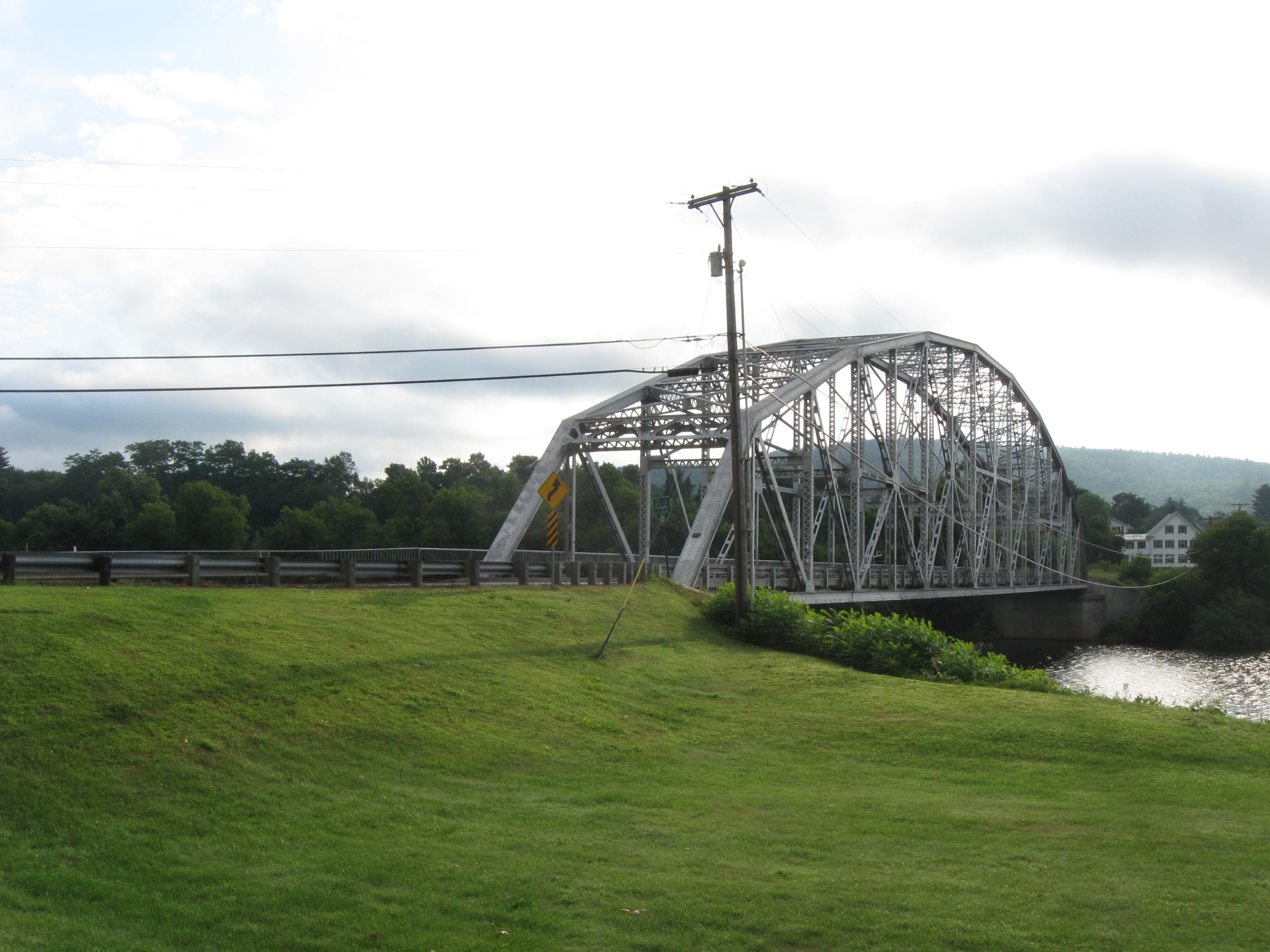
Wells River and Woodsville – joined by a bridge across a dramatic narrows of the Connecticut River – were once a major station both in the Connecticut’s long history of log drives and the railroad. It’s said they host the ghosts of river drivers and train wrecks. The rich intervale meadows of the river’s flood plain drew settlers up the Connecticut River and across the White Mountains from coastal New Hampshire in the late 1700s. Two major tributaries swell the Connecticut here, providing some of the finest white water in the Byway. Historic architecture graces village centers and residential neighborhoods from the valleys to the hilltops. The Byway traces the routes of some of the oldest roads in the Connecticut River Valley.
 Wells River, VT, and Woodsville, NH, cooperatively provide the Waypoint community for an area that includes the towns of Haverhill, Piermont, Bath, NH, and Newbury, Bradford, and Ryegate, VT. They host a Waypoint Interpretive Center in Wells River, just west of the bridge leading to Woodsville. Another Waypoint Interpretive Center has opened in the 1846 Grafton County Courthouse, now known as Alumni Hall, located in historic Haverhill Corner on Route 10 south of Woodsville.
The designated Byway routes in the Wells River-Woodsville area in Vermont is Route 5. The Byway continues in New Hampshire on Route 135 from Woodsville to points north, Route 302 from Woodsville to Bath Upper Village, and Route 10 from Woodsville to Haverhill Corner and points south.
Nature & Scenery
 Here the Connecticut takes a sinuous path across a broad flood plain between ridges in both states. Its large S-curves are known as “oxbows” for their resemblance to the shape of the wooden yokes used to harness oxen. Flooding periodically cuts new channels and fills in old ones. Between Bradford and Piermont is perhaps the only place on the river where one can walk between the two states. A flood in the 1950s cut off an oxbow, and part of Bradford became an island. Sediment has since built up, linking the island with the New Hampshire bank.
The Ammonoosuc River spills into the Connecticut near a scenic covered bridge, where the river takes a hard turn and dives through “the Narrows” to meet the Wells River, entering from the Vermont shore. No Man’s Island, which stands between them, marks the border of two states and four towns.
Kinder Forest, Haverhill’s municipal forest, includes hiking trails. Another natural area is Bedell Bridge State Park (see Recreation, below) where old stone bridge abutments stand amid farmlands. Here, just below the mouth of the Oliverian River, is a well-known birding area.
Farming
Before the arrival of Europeans, Native Americans farmed the floodplain in these bends of the river that became known as the Cohass Meadows, meaning “place of wide valleys.” These rich soils prompted New Hampshire to lay out a road through its wild interior from Haverhill to the seacoast to bring food to its growing coastal population. Several farms in the area retain historic round barns, constructed in that shape in an attempt to make their operation more efficient.
History
Early roads opened up the area variously known as Cohass, Cohase, and Coös to settlement. The Province Road was built about 1773 from Concord through the White Mountains to what is now Haverhill Corner. Returning veterans of the French and Indian Wars had brought back news of the area’s agricultural possibilities as early as 1761, when it was discussed in the New Hampshire Assembly. By the early 1770s, there was regular mail service between Haverhill and Portsmouth, through Concord. Haverhill became the terminus of the Coos Turnpike in 1808, spurring the growth of a vigorous town center.
Just across the river from Haverhill, Newbury was settled in 1763 when General Jacob Bayley, veteran of the Indian wars, led a migration of settlers from Newbury, Massachusetts. In 1776-1779, Bayley constructed a road from Newbury 54 miles northwest, intending to create a better route for American Revolutionaries to invade Canada than through British-controlled Lake Champlain. It was never used for an invasion, but after Moses Hazen extended the road, the Bayley-Hazen Road became an avenue for trade and settlement. Resulting hilltop settlements along the highland roads remain like guide fossils to the early road that produced them.
Many of the villages are recognized historic districts. There are six in Newbury alone, one in Bradford, and one in Haverhill. Along Route 302, in Upper Bath Village, stands a fine collection of Federal-style residences made of brick and wood. One is a bow-front brick home that resembles the finest homes in historic Boston. These houses testify to the wealth and sophistication of the residents of this rural area as early as 1800. The Brick Store in Bath is one of the oldest country stores in the nation.
The town of Bath is also distinctive for the number of its surviving historic covered bridges. Two that span the Ammonoosuc River are the Bath-Haverhill Bridge, located in Woodsville is the oldest documented covered bridge in the United States, and the Bath Bridge. The Swiftwater Bridge spans the Wild Ammonoosuc River.
For a closer look at the rich history of the Lower Cohase region, take a driving tour.
Recreation
The Cross Vermont Trail welcomes bicyclists to ride along a portion of former railroad bed leading west from Wells River.
Bedell Bridge State Park, Haverhill NH
Railroads
An historic railroad bridge spans the Connecticut between Wells River and Woodsville, where the historic train station has been converted to a commercial building. The three-story wood-framed building is still called “Woodsville Station.” Behind it and to the east, the large level area once teemed with activity where several railroad lines came together.